4 Corners?
This is the HOME page for a 2017 motorcycle adventure, probably my last ride. The initial idea was to do what is known as the Four Corners USA ride (not to be confused with the Four Corners location where four states meet). The Four Corners USA are: Key West FL (Southeast), Madawaska ME (Northeast), Blaine WA (Northwest), San Ysidro CA (Southwest).
But, given it’s probably a “last ride,” I sought something more ambitious: Hence…
8 Corners!
My plan now involves four more ‘corners:’ The northern ‘corner’ of the Upper Peninsula of Michigan, where US Route 41 dead ends into Lake Superior at Copper Harbor; Fairbanks, Alaska; Homer, Alaska; and the southern tip of Texas at either Corpus Christi or Brownsville. So the sequence would be, in order:
- Key West
- Madawaska, Maine
- Copper Harbor, Michigan
- Fairbanks, Alaska
- Homer, Alaska
- Blaine, Washington
- San Isidro, California
- Brownsville, Texas
The “Plan” was weather, body, and motorbike permitting. And weather there was: Hurricane Harvey prevented entering into Texas beyond Texarkana, and Hurricane Irma, put an exclamation point on the ride’s end as I had to get home to pack up and evacuate Florida.
In this way I will have reached both the southern and northern ends of both US Route 1 and I-95 that run along the East Coast, and Route 41 that goes up the heartland through Chicago, all three beginning in Miami (and in the case of Route 1, it actually extends down to Key West).
The first iterations of the beyond 4 Corners USA ride, a 5 Corner Ride, was below:
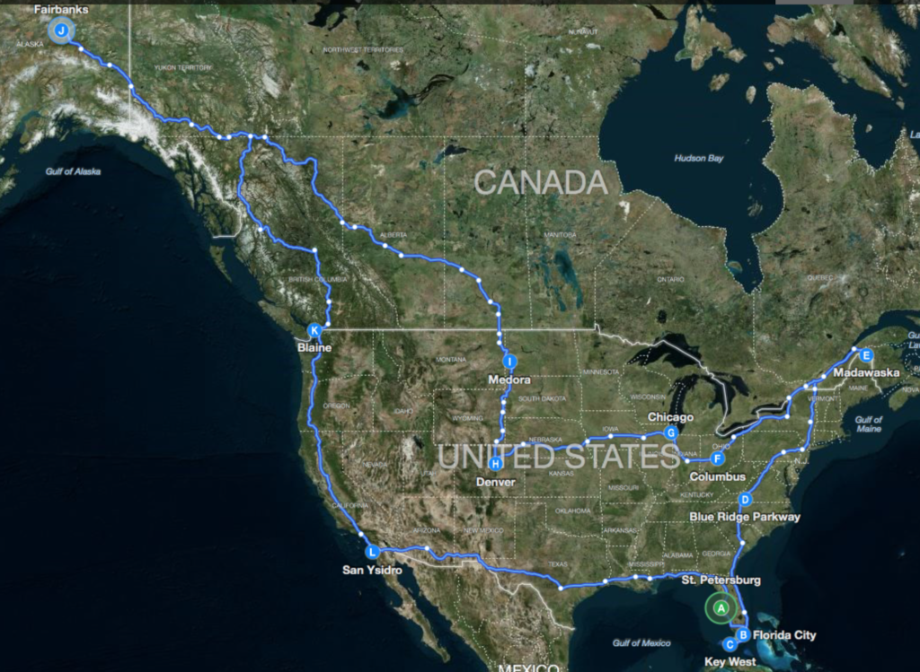
As of mid-August in Denver, here is what the actual ride history looks like. It generally flows counter-clockwise except there’s a cross-over between Stewart BC (point R) to Jasper (S) to Spokane (T), where it then continues counter-clockwise.
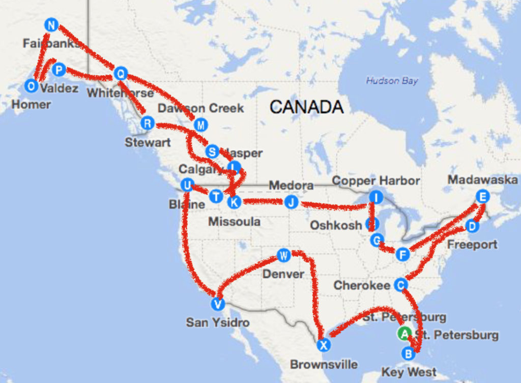
However the route from Denver to Brownsville Texas was not a straight southerly shot as there was a total (as in TOTAL) eclipse to be witnessed on Aug 21. That truly once-in-a-lifetime opportunity, and choice, turned out to ‘cost’ me the opportunity to reach Brownsville TX (or anywhere close) because Hurricane Harvey struck during my side trip to Paducah KY to see the eclipse. This extended the original plan for the 8 Corners Ride to include many side excursions so that it entails 23,000+ miles, which is, notably, the around-the-world distance, and 47 States.
UPDATE LATE AUGUST 2017:
The chart just above was done when I was in Denver, showing the plan for Corner #8 (Corpus Christi / Brownsville TX) and return home. Since Denver, however:
(1) I headed West from Denver circling Colorado,
(2) went North to Wyoming and North Dakota,
(3) East to Iowa,
(4) South to Nebraska, Kansas, and Oklahoma,
(5) East again to Missouri, Tennessee, and Kentucky [to see the eclipse totality in Paducah, which was a truly once in a lifetime experience],
(6) West again to Arkansas and into Texas with the then goal of Corner #8.
However, Harvey the Hurricane then loomed ominously over the direction of travel through Southwest Texas and Houston in particular. It seemed beyond stupid to attempt that leg of the trip. So I have turned back East across Arkansas, Louisiana, Mississippi, Alabama, Georgia, and South Carolina, revising this Adventure to a 7-Corner, 47 State experience (and two Canadian Provinces and two Canadian Territories).
I am way behind in updating all these travels as there is not enough time and energy at the end of each day’s ride. When I return home, someday soon, I’ll work on doing so.
UPDATE SEPTEMBER 2017
I completed the modified 8 Corner ride as summarized in the below image: 99 continuous days of travel, covering 23,350 miles, 47 states, and 4 Canadian Provinces and Territories. A motorbike pictorial summary of the journey is here:
Such mileage corresponds to more than an around-the-world trip: the great circle circumference of the earth is just under 25,000 miles; however if one goes East to West at some constant latitude, say 28 Degrees corresponding to Tampa, that distance is actually, exactly = 24,901 * cosine(28 degrees) = 22,000 miles, QED.
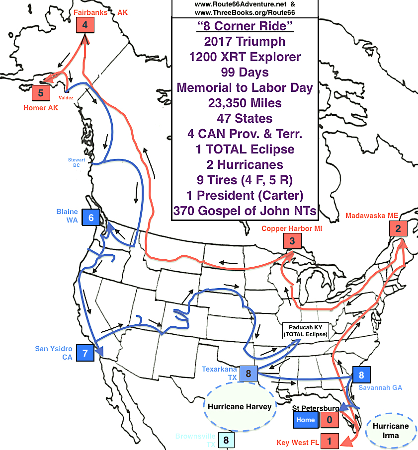
Here (again) is the link to the pictures of my motorbike, Nicodemus, at various locations in chronological order, on the 99-day Adventure.
The Motorcycling Beginning
The last leg of my 2016 pedaling of Route 66 could not be done by pedaling because of knee surgery after Adrian Texas. That last leg, Leg 5, was done on an impulsively purchased motorcycle just to complete the goal. However, that was such a blast, other possible motorcycle adventures became of interest. And the initial inspiration of the 4 Corners USA adventure was born.
Probably foolishly I thought to upgrade my motorcycle from the very able and really excellent VSTROM 650 I used on Route 66 Leg 5. I replaced it with a Triumph 1200, which is able to carry considerably more gear, with a lot more zip, and, well, I don’t plan to be able to do this kind of thing very much longer. (It’s my version of Doc’s explanation of why he used a DeLorean to Marty in Back to the Future). Speaking of Back to the Future, I did do a Cape Kennedy to Fairbanks Alaska trip in 1969-70, first to Portland Oregon, and then in 1970 from Portland up to Alaska on the then unpaved Alcan Highway. (I understand, and hope, it’s paved these days [it is, mostly]).
I am using a motorcycle GPS made by TomTom (Model 400) which has many great options including routing for back roads that are twisty and with elevation changes. I plan to use this as much as possible to (1) stay off ‘slabs’ (aka Interstates), (2) away from ‘cities’ (anything bigger than a “town,” defined as not greater than 20,000 population), and (3) see national and state parks, other scenic areas, small towns, and occasional well-maintained dirt roads.
Day 1 of bike ownership: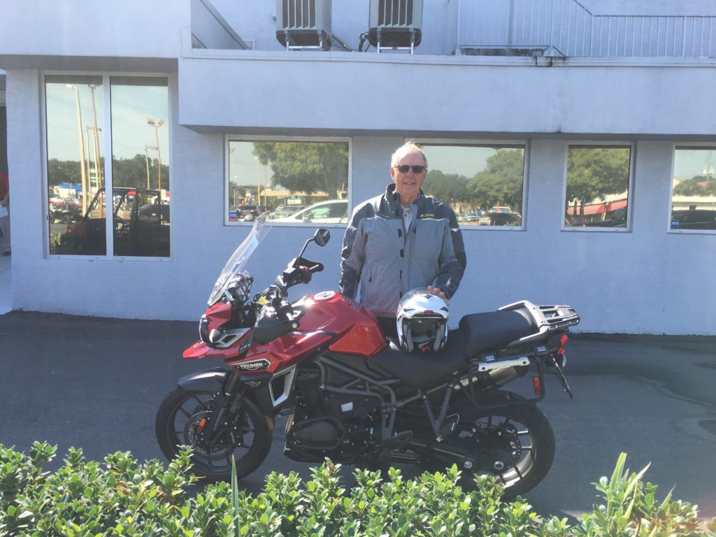
Adding a top box to the panniers.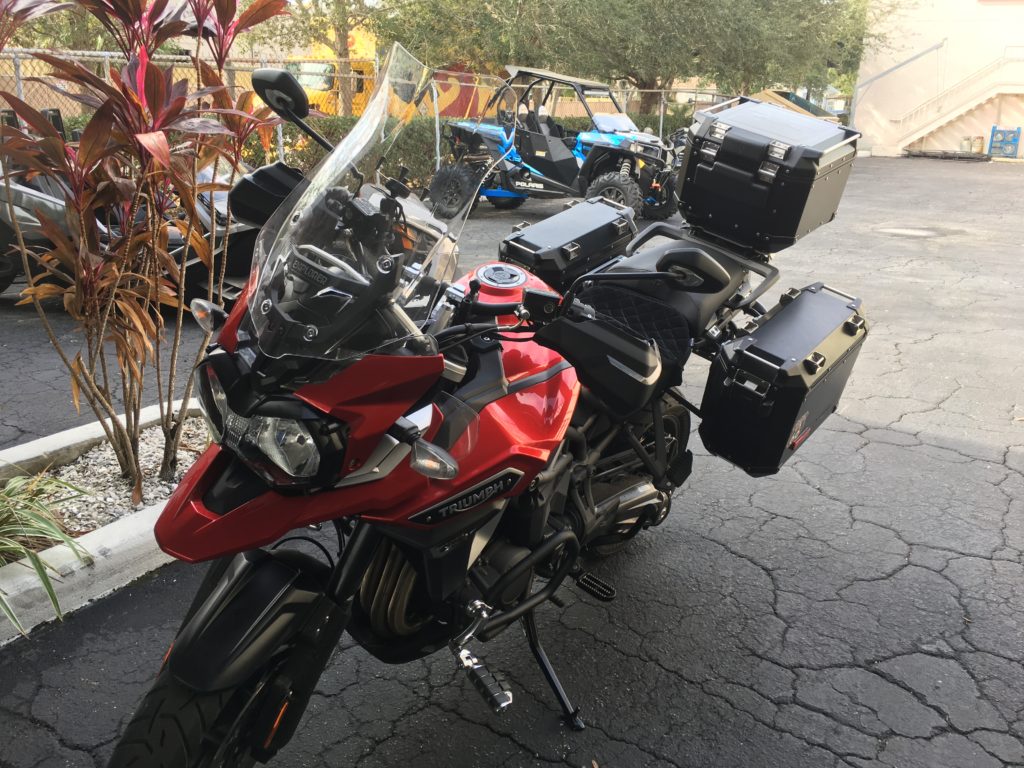
Trial load with camping gear. (Note the Route 66 remembrance sticker on the port-side pannier).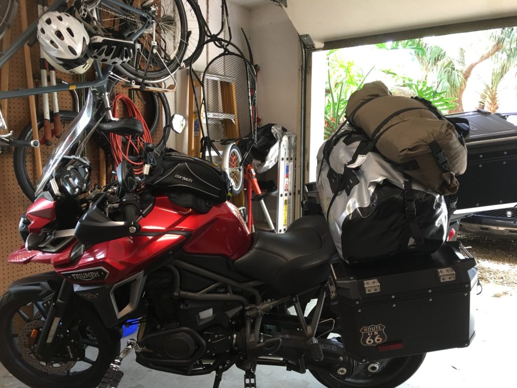
My initial ride map, shown above on this page, included Fairbanks, Alaska but not all 8 corners. If I can average 300 miles a riding day and an equal number of days “off” as riding, this makes for a 100 day trip, if uninterrupted. However, I anticipate parking the bike (“Nicodemus”) and flying to meet various other obligations (which as of mid-August I’ve completed 7 Corners and nearly 19,000 miles, has not been necessary).
As I go, I share the Gospel by giving out copies of the Gospel of John with my adventure travel card. (These were made using the very helpful and inexpensive online resource Vistaprint.com).
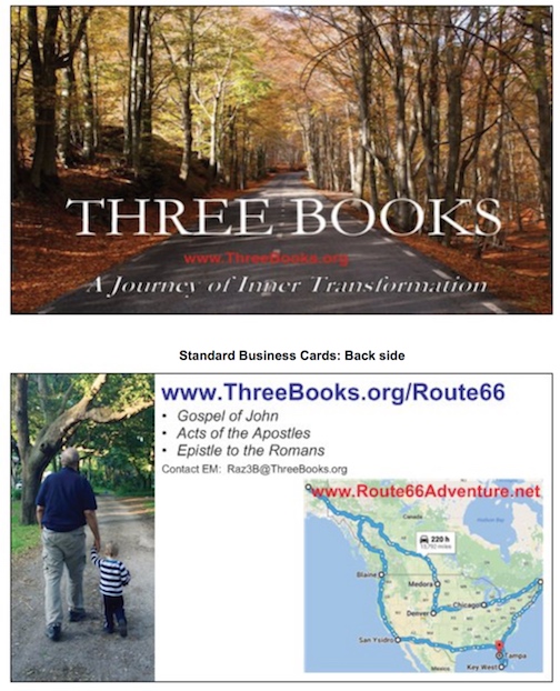
The travel card introduces the two adventures: the obvious one in space and time as shown on the Google map, and the inner, spiritual one that is required of us all. Regarding that inner journey, I wrote and self-published a book entitled Three Books. As the title suggests it was itself about three books, specifically three key books of the Bible: The Gospel of John, the Acts of the Apostles, and the Epistle to the Romans. My writing provides a light, introductory, adventure-context commentary side by side with the texts of these three New Testament books to support a person who has not read much, or recently, of the Bible. The Gospel of John pocket book that I hand out on my Route66Adventure is produced by the Pocket Gospel League and is available here.
Leg 1: St Petersburg Florida to Key West FL
DONE! Story and images at the above link.
Leg 2: Key West FL to Madawaska Maine
DONE! (Including the 469 mile ride up the Blue Ridge Parkway, and necessary pilgrimage to LL Bean in Freeport Maine). Story and images at the above link.
Leg 3: Madawaska, Maine to Copper Harbor, Michigan
DONE! (Including Columbus Ohio, Chicago, Oshkosh Wisconsin and the fabulous museum of the Experimental Aviation Association). Story and images at the above link.
Leg 4: Copper Harbor to Fairbanks, Alaska
DONE! (Including a trip north of Fairbanks to Joy, Alaska about 100 miles north of Fairbanks on the Elliott-Dalton Highway). Story and images at the above link.
Leg 5: Fairbanks to Homer, Alaska
DONE! (Including a trip to Valdez, Alaska, another southern port of Alaska). Story and images at the above link.
Leb 6. Alaska to Blaine, Washington
DONE! (Including a trip to Stewart BC, and eastward to the famed national parks of Alberta Canada: Jasper, Banff, and Lake Louise, and into and across Idaho and Washington). Story and images at the above link.
Leg 7: Blaine WA to San Ysidro California
DONE! (Including trips from the Willamette Valley west to the Pacific Ocean and east to Mt. Hood / Timberline Lodge, and down the various roads through all the magnificent redwoods of northern California). Story and images at the above link.
Leg 8: San Ysidro CA to Brownsville Texas
DONE! This became a long circuitous leg and ultimately had to be modified because of Hurricane Harvey. I left Los Angeles by way of Las Vegas, 4 Corners (where the states of UT, CO, NM, and AZ meet), Durango and Denver Colorado, then onto to Wyoming, South Dakota, Nebraska, Iowa, Missouri, Kansas, Oklahoma, Arkansas, Kentucky, Tennessee, back to Arkansas, and to Texas. At this point and by this time Hurricane Harvey was trained to landfall in SW Texas along the coastline from Houston all the way to Corpus Christi and Brownsville. So I turned back and chose instead Savannah as my Corner 8, by way of Louisiana, Alabama, Mississippi, Georgia, and of course South Carolina.
Home Leg: Brownsville TX to St Petersburg FL
DONE! The Home Leg was directly south from Savannah, but avoiding the interstate highways as much as possible, through Georgia, and the Florida east coast, before heading across the state west to St Petersburg.
I left on the Saturday of Memorial Day and arrived home 99 days later on the Saturday of Labor Day.